12th - 16 August
The Littorale route after Lanloup continued to impress us with the size of the climbs and descents and we found ourselves doing shorter days because were tired, not just because of the temperamental rain. We haven’t stopped at museums or ‘monuments’ very much, though the church (15-16 C) at Lanloup was particularly impressive for its porch statues of the apostles.
 |
| Porch Lanloup - Half of the 12 Apostles |
There was also a stone of remembrance we passed at the site of “La maison d’Alphonse”, a house used by the resistance, destroyed by the Germans in July 1944. Between January and August, 135 Allied airmen shot down over Europe were taken off the coast by the Royal Navy from the beach below the cliffs, in 8 rescue missions. The area was mined and closely monitored by the Germans, so a pretty big achievement. The beach was code-named Bonaparte’s Beach and a Radio London message to La maison d’Alphonse, on a moonless night let the resistance know that the Navy was coming.
 |
| Bonaparte Beach - Shelburn Line of repatriating Allied airmen |
Something special: Fish soup from a lone seafood restaurant on a beach with nothing much else except for wholesale fish/shellfish sales, which they seemed part of. Obviously they had a clientele who knew their reputation, as their menus were expensive and they had holding baths for oysters, mussels, lobsters/crayfish, crabs… However, we decided that the fish soup was not only affordable but also probably as much as we could eat at that time of time, with all the hills. Good choice. The soup was absolutely delicious and came with side containers of cream, grated cheese and croutons. We like food and this was really special. And sufficient.
 |
| Soupe pêcheur, Tréveneuc (Grève de Saint-Marc) |
 |
| The beach at Grève de Saint Marc |
We still marvel at the difference in this region between high and low tide (fifth highest in the world). The Royal Navy in the Bonaparte Beach situation above had to factor in the tide rise and fall (sometimes 40 feet, they said), together with moonless nights. We go past a tidal river or port to see all these poor little boats high and dry and metres of mud banks. Then passing the same place or similar later, the port or beach is all ‘ship-shape’ and the boats are bobbing proudly on the tide.
 |
| Out of water |
 |
| In water - different place but same principle |
In Binic we had an extra high tide, and that of the morning was even higher than the evening before. We had intended to take a shortcut over a footbridge but the approach to the footbridge was under water!
 |
| Footbridge approach under water with grande marée (extra high tide) |
Pontoons really come into their own with this amount of movement. In Binic our camping ground was on the top of the cliff (DO NOT MENTION the hill we had to push our bike up to get there from the information office!). From there we could see way, way out across the sands where people were using the extra-low tide to gather shellfish.
 |
| Tide way out, people gathering shellfish |
 |
| Tide covers the flats - view from Binic camping ground |
Later in the day, as we returned to the campground via the (much easier) cliff path for pedestrians, the extra high tide was whacking the sea wall and people were swimming right in by the shore, as if it were a moving swimming pool.
 |
| Watch this sea wall - tide well in now |
 |
| Tide whacking sea wall |
Paekakariki could use one of those sea walls… There is also a tunnel built by the Germans during the war, which gives access to the beach from the town.
 |
| Tunnel dug by Germans, WWII |
More special stuff: In among all the long steep hills there is a patch of old train line that has been restored for cyclists. Only about 8km but brilliant and going over a viaduct, also restored. For the record, (and from a sign on the bridge), the restoration was paid for: 50% by Europe, 30% by Brittany and 20% by the local region.
 |
| The restored viaduct on the cycle track |
Along the way a bit is a 'shelter shed’ and a lunch table WITH A RUBBISH BIN. We made use of all three, especially since we knew the threatening rain could come at any time.

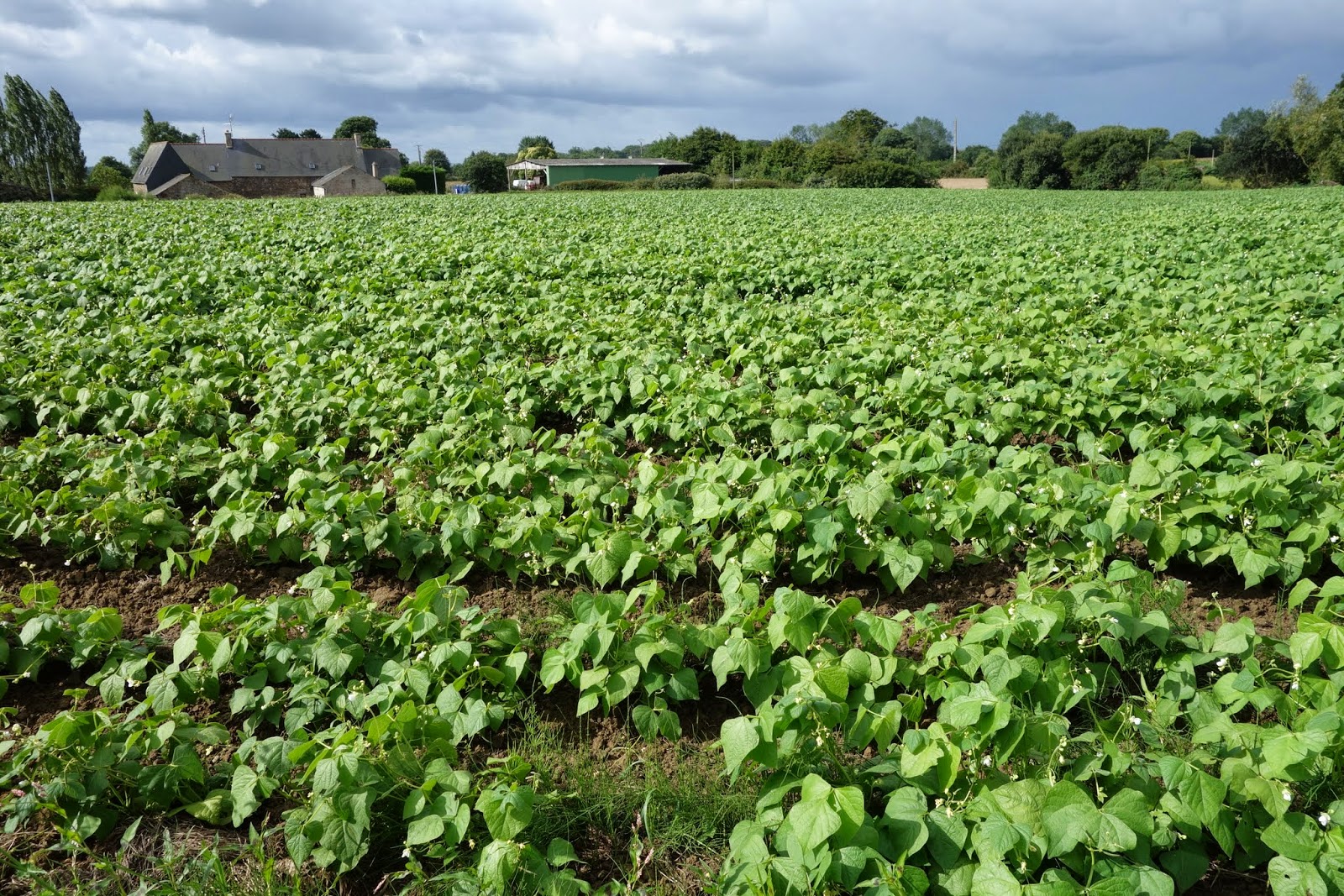
Extra crops we have noticed: beans, lots of beans, and newly planted green stuff that looks like spring onions but then again could be leeks.

Acknowledgement: The guy who runs the bike shop near the port of St Brieux - Breizh Riding (Breizh is the Breton word for Brittany) - replaced both the magnets on our cyclometers and refused to charge us, as he 'has lots’.
Just along from the bike shop, by the lock, the next hill starts.
 |
| Looking down on this steepish climb which starts after the lock below |
After the steep bits getting out of Port St Brieux we skirted around a long inlet which is a nature reserve. Very pleasant late-afternoon ride. Uphill again out of the inlet but the camping ground ended up being way out on the coast, 7km off our track, on a windy afternoon threatening rain. So we opted for a hotel again. Very pretty little village where we stayed two days (rain again). Not a lot in the village but an interesting church right over the road.
 |
| Stayed 2 days here - Hillion |
 |
| The church over the road |
From here to Dinard, from where would go to St Malo, was another couple of days, of ups and downs interspersed with a bit of train track and a viaduct or two.

The stand-out site was the lighthouse at Cap Fréhel. Lighthouses here have served as watchtowers for the coast from St Brieuc to St Malo since Vauban first recommended building one there. (Built 1701-2.) The replacement lighthouse came in the 1840s. We are now onto Lighthouse 3. The Germans blew up lighthouse 2 when they were ‘obliged' to abandon in 1944. The system had to revert to the Vauban Tower! The current one is 1946-1950. Striking site, high on the cliffs and in an area where the plants are protected (use only pathways if you are walking).


The last day of biking before we reached Dinard was both longish - 52km and quite a lot of ups and downs, and ups and ups and downs, about 420m up and 440 down. It typified again what we had already passed through. This is known as the Emerald Coast. Some beautiful views of bays, with ‘emerald' water, some lovely little towns, a wide variation of surfaces, a variety of crops.


Dinard is a busy beach resort, first made popular in the late 19th century when the wealthy (especially British and Americans) built huge villas on the cliff tops and exclusive hotels on the seafront. It declined in the 30s when the Côte d’Azur became popular with the wealthy. Nevertheless, the beaches were crowded, the streets full of crawling traffic, and apart from marvelling at the architecture we found little to attract us and bought our boat tickets for St Malo.

 |
| Dinard |
We knew we would have to cross back to Dinard to follow the cycle paths back to the southern coast of Brittany after St Malo, so we bought a return ticket. At over 30€ for two people and 2 bikes, that was considerably more than a night’s accommodation (€15.70), for a 10 minute boat ride each way. However, that’s the way it is in popular seasonal places and it was far better than battling main road traffic. And besides, on the boat we met Sandy.
 |
| St Malo |
Sandy rode the Nullabor a couple of years ago and just loved it. She’d just spent about a month in Scotland, biking round in the rain and cold. She’d passed through St Malo a few weeks previously and was now on her way to Jersey. She knew where the camping ground was, the one close to town. But she had a few things to sort, like tickets to Jersey, so we waved goodbye, see you later and went our separate ways. We didn’t know where the camping ground was and needed the Tourist Office to find out. Cars were absolutely everywhere, going both directions. We decided to go inside the walls - the streets were full of people,waves of people, going in both directions. Plus cars. We found our way to another gate and got outside the walls again. Deftly biking through parking areas (no show on the road), we got to the tourist office and asked for a map. “Do you have a reservation?” “No” (We don’t do reservations, as we never know where we'll be). "The camping ground is full. Complet." Okay, so where is the next one? “Everything is full here. The camping grounds, the hotels, everything. Full. Long weekend, mid-August”. So where do we go then? "You should go back to Dinan (30km or so) or XX, or XX " (unknown places further away, circled on a map). Well, that wasn’t on, so we biked to the camping ground (up a hill), where we were duly greeting by a COMPLET sign on the gate. I had already worked out my plan of attack - but - unnecessary! Sandy had beaten us there, had a site and had told the guy behind the desk that two more NZers were coming and she was very happy to share the site. Which was actually huge! Yay, Sandy! We shared a couple of pizzas and talked about lots of cycling stuff and were very pleased to have met each other!
St Malo was the end of our travels along La Littorale. Next stage - get back to Redon, where we started the Brittany exploration.
A few more photos, mostly around Binic.


No comments:
Post a Comment