Friday, 29 August 2014

On boucle la boucle - we come full circle

Last leg - Brittany from north to south
17-21 August 
St Malo to Redon


The distance we had to travel was a bit over 200km and the nature of the cycle track - old railway line and canal path - meant that we were able to make good time, even though I was under attack by various symptoms preying on my somewhat low resistance. We (and fellow-travellers) found the nights cold and we ended up under a roof more nights than in our tent. 


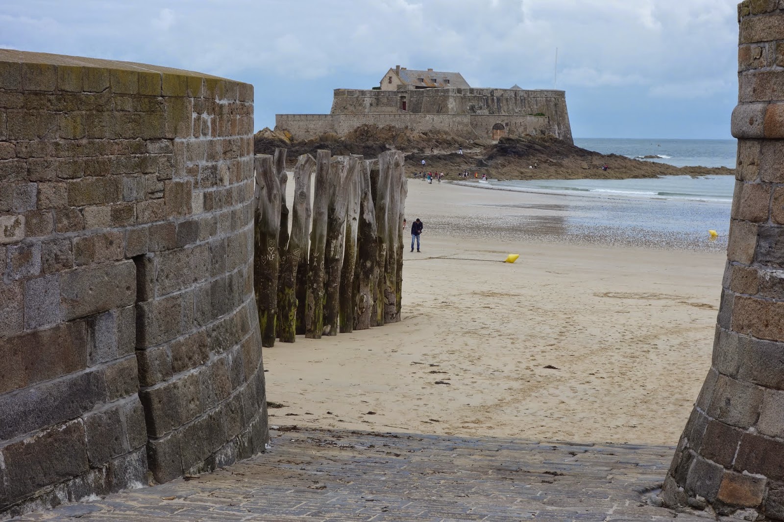
We managed to get to St Malo itself (from the camping ground) before the crowds - this is a busy seaport, with ferries going to Jersey, Guernsey and the UK. It also has a walled portion of the city (rebuilt or restored after the war) which attracts great numbers of tourists. In fairness, there are some lovely buildings, with a castle and ramparts (Vauban) to walk around - September is a good time to do that.


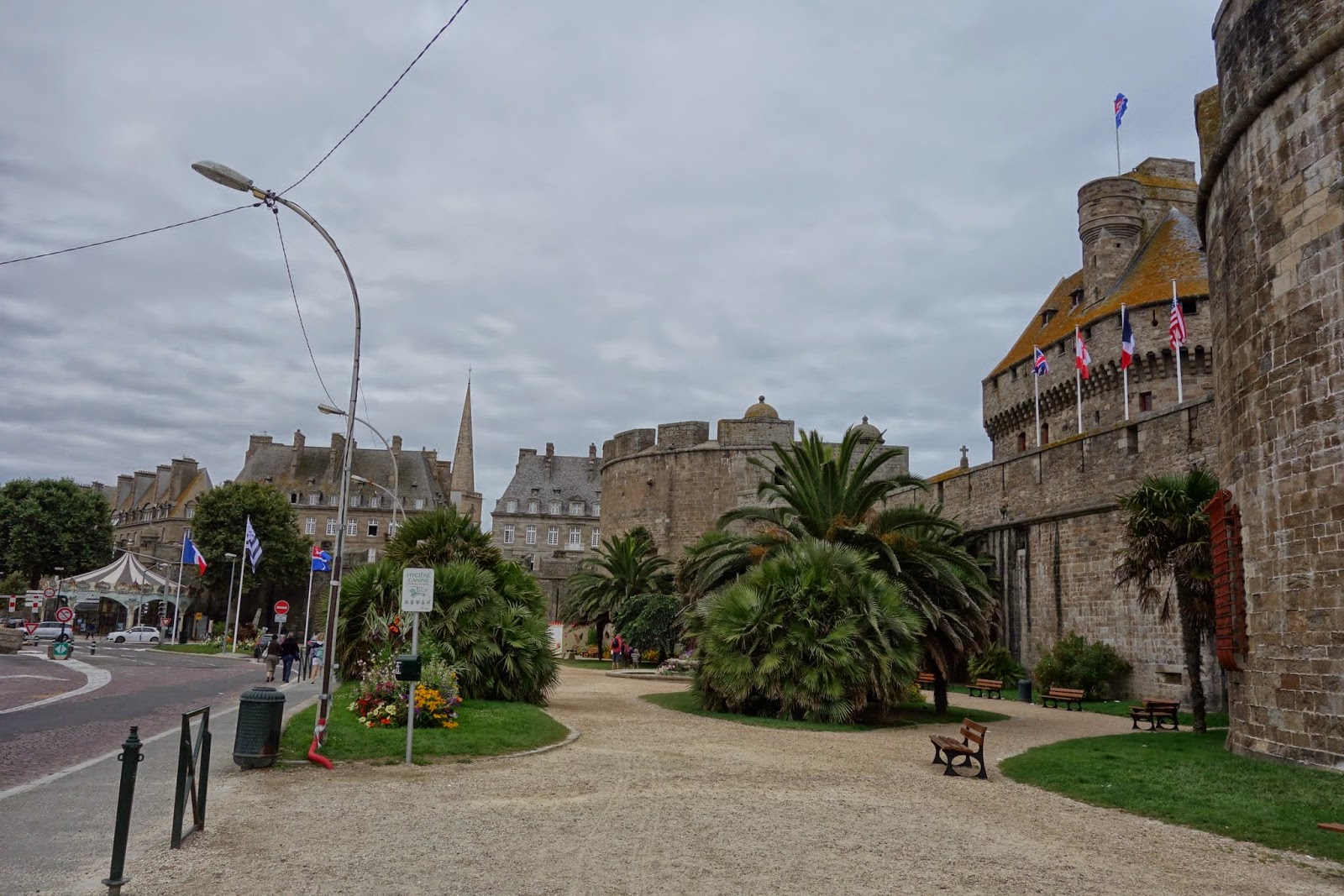
There are also many mansions, dating from its colourful past and wealthy times sometimes functioning as hotels now, especially along the seafront. We explored quite a bit of the seafront on our bikes, finding a lovely cafe with sea view to have our morning coffee in. Very tranquil. 


By the time we left, about 10-ish, there were already people about and we started to feel closed in, so quickly took ourselves to the boat harbour for the crossing. the view of Dinard from the boat is spectacular, with the cliff mansions. And St Malo looking back to the walled ‘fort’ is also spectacular.


We didn’t get straight onto the bike track (no arrows) but caught up with it just out of town. The path at this point is largely an old train track, which we had come up the day before, and easy to follow, even if you’re not feeling very well - I was coming down with something - so progress was very steady. I tried out a new technique - going more slowly so that I might last the distance better. It seems to work. 


The first day out the camping ground we intended to go to was no longer open, and the second one not suitable either, as there were no open shops to buy food from. Eventually we arrived at a suitable site (close to 70km on) and there was even a pizzeria with well-priced pizza in the town. We didn’t get to Dinan, as there was no arrowed side-trip from the cycle path and we didn’t realise we had missed until quite a bit later. However, Dinan has a train connection, so if we want to go there one day it will be easy.


First night

Our second day wasn’t hard, as we had reached the canal before Dinan and we just had to putter along. Still feeling far from brilliant I took the day slowly and we called it a day about 4.30pm, 35km, finding a bed and breakfast (chambre d'hôte) in a hilltop village/town just outside Rennes. Outside our normal budget, the B and B was an old presbytery  (which seems to have a wide range of equivalents in English) which the current owner, a retired builder, had completely rebuilt, in the interior, over the previous 2 years. He had done an outstanding job, even covering the old concrete stairs with beautiful wooden boards, which of course don’t creak! We loved our night there and the breakfast next morning was the cherry on the cake, even including freshly-cooked crêpes and freshly-squeezed orange juice. He hasn’t finished yet, as he has plans to convert the attic into accommodation for children and grandchildren.


The garden of the Chambre d'hôte 
Second night

No time at all to get to Rennes (16km) where we found a hotel near the station (often well-priced hotels near the station) and spent the rest of the day exploring. There is a lot to see and a return visit is on the cards. The baths, dating from about 1925, were closed and people we met later said they really are worth seeing. Beautiful mosaics and they have apparently kept the bath house as it was, though upgraded and maintained. Unlike the Rotorua Bath House (1908), which I saw in its original form as an adolescent. It has not been a functioning bath house for decades but they have retained some of the architectural features. Back to Rennes - there are lots of historical buildings here and there is a map with walks on it. The Tourist Office also has lockers, so if we had wanted to spend just the day there it would have been possible to leave the bikes and luggage and do the walks on foot (a necessity if you want to see things properly).


The baths 


The last two days were roughly 50km each, simply following down the river/canal - there is a convenient camping ground at a place called Guipry,where two Voies Vertes meet at right angles (one is on an old railway bridge so crosses above the other) just where the camping ground is placed. 


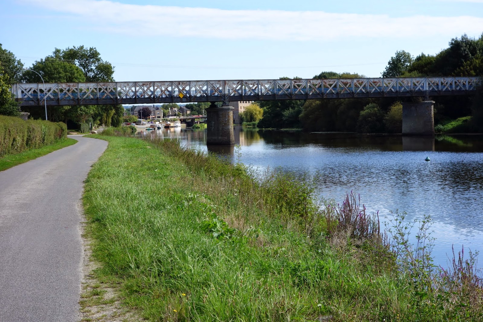
And 500m down the road is a small supermarket (Leader Price), selling anything we might need. When this happens we think it is great! There is a big supermarket a bit further away but we didn’t need it and didn’t go there! We had a good look around the town - across the bridge is a separate town called Messac, and a railway station called Messac-Guipry. It’s been there since the mid-19th century and still going strong! There’s a bar installed right over the river, which looked fabulous in the setting sun and we were sorely tempted but we had already bought our meal ingredients and light fades quicker in late August. More photos from this section:


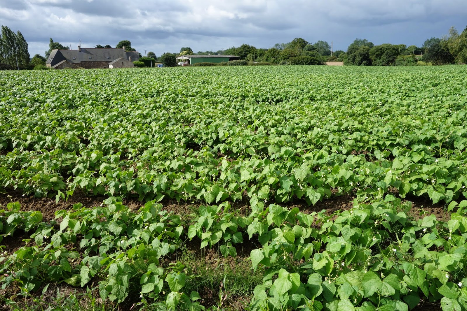
The last leg, to Redon, was both pretty and interesting. There were lots of sections beside the canal which had some dwellings on them. We would have called these baches once. (Or cribs in the far south, Tracey.)  I’m not sure if we still do or not, and I’ve no idea if the French have a special name. A number of them have names, such as SAM SUFFY (ça me suffit - this is enough for me), just as a number of the traditional NZ baches did (DUN WIRKEN, for example). Maize as far as the eye could see at times, some lovely arched bridges, like those in our English-based story books in the 50s. Still livestock to be seen - in fact we saw our biggest herd yet - maybe as many as 60 cows all calmly settled in their field. (Average herd size 2006, 43 - hard to find up-to-date figures but I did see that in 2013, 21.6% of France's milk production comes from Brittany.)


Flood levels (recent)
Maize, maize and maize
Not unusual to see relics of the past
Back in Redon, where we have twice camped some kilometres away from the centre, we found a hotel in the centre. The owner/manager has even been to NZ! Redon was where we started the ride around Brittany from all those weeks ago, and it was good to get back there - some sort of sense of completion. We even caught up with the people who run a sandwich/coffee bar, who had helped us out with huge ham sandwiches one evening when there was nothing handy open to buy ourselves food for the camp-ground. They remembered us too and we enjoyed a breakfast there - we had come full circle. 

Redon station - end of this ride
And the train had all the bikes it could carry - 4 more doorways like this one

Wednesday, 27 August 2014

Ups and downs - The Emerald Coast, to St Malo


12th - 16 August

The Littorale route after Lanloup continued to impress us with the size of the climbs and descents and we found ourselves doing shorter days because were tired, not just because of the temperamental rain. We haven’t stopped at museums or ‘monuments’ very much, though the church (15-16 C) at Lanloup was particularly impressive for its porch statues of the apostles.

Porch Lanloup - Half of the 12 Apostles


There was also a stone of remembrance we passed at the site of “La maison d’Alphonse”, a house used by the resistance, destroyed by the Germans in July 1944. Between January and August, 135 Allied airmen shot down over Europe were taken off the coast by the Royal Navy from the beach below the cliffs, in 8 rescue missions. The area was mined and closely monitored by the Germans, so a pretty big achievement. The beach was code-named Bonaparte’s Beach and a Radio London message to La maison d’Alphonse, on a moonless night let the resistance know that the Navy was coming.

Bonaparte Beach - Shelburn Line of repatriating Allied airmen 

Something special: Fish soup from a lone seafood restaurant on a beach with nothing much else except for wholesale fish/shellfish sales, which they seemed part of. Obviously they had a clientele who knew their reputation, as their menus were expensive and they had holding baths for oysters, mussels, lobsters/crayfish, crabs…  However, we decided that the fish soup was not only affordable but also probably as much as we could eat at that time of time, with all the hills. Good choice. The soup was absolutely delicious and came with side containers of cream, grated cheese and croutons. We like food and this was really special. And sufficient.

Soupe pêcheur, Tréveneuc (Grève de Saint-Marc)
The beach at Grève de Saint Marc

We still marvel at the difference in this region between high and low tide (fifth highest in the world). The Royal Navy in the Bonaparte Beach situation above had to factor in the tide rise and fall (sometimes 40 feet, they said), together with moonless nights. We go past a tidal river or port to see all these poor little boats high and dry and metres of mud banks. Then passing the same place or similar later, the port or beach is all ‘ship-shape’ and the boats are bobbing proudly  on the tide.

Out of water

In water - different place but same principle

In Binic we had an extra high tide, and that of the morning was even higher than the evening before. We had intended to take a shortcut over a footbridge but the approach to the footbridge was under water! 

Footbridge approach under water with grande marée (extra high tide)

Pontoons really come into their own with this amount of movement. In Binic our camping ground was on the top of the cliff (DO NOT MENTION the hill we had to push our bike up to get there from the information office!). From there we could see way, way out across the sands where people were using the extra-low tide to gather shellfish. 


Tide way out, people gathering shellfish
Tide covers the flats - view from Binic camping ground

Later in the day, as we returned to the campground via the (much easier) cliff path for pedestrians, the extra high tide was whacking the sea wall and people were swimming right in by the shore, as if it were a moving swimming pool. 

Watch this sea wall - tide well in now

Tide whacking sea wall
Paekakariki could use one of those sea walls…  There is also a tunnel built by the Germans during the war, which gives access to the beach from the town.

Tunnel dug by Germans, WWII

More special stuff: In among all the long steep hills there is a patch of old train line that has been restored for cyclists. Only about 8km but brilliant and going over a viaduct, also restored. For the record, (and from a sign on the bridge), the restoration was paid for: 50% by Europe, 30% by Brittany and 20% by the local region. 

The restored viaduct on the cycle track

Along the way a bit is a 'shelter shed’ and a lunch table WITH A RUBBISH BIN. We made use of all three, especially since we knew the threatening rain could come at any time.


Extra crops we have noticed: beans, lots of beans, and newly planted green stuff that looks like spring onions but then again could be leeks.


Acknowledgement: The guy who runs the bike shop near the port of St Brieux - Breizh Riding (Breizh is the Breton word for Brittany) - replaced both the magnets on our cyclometers and refused to charge us, as he 'has lots’. 

Just along from the bike shop, by the lock, the next hill starts. 
Looking down on this steepish climb which starts after the lock below


After the steep bits getting out of Port St Brieux we skirted around a long inlet which is a nature reserve. Very pleasant late-afternoon ride. Uphill again out of the inlet but the camping ground ended up being way out on the coast, 7km off our track, on a windy afternoon threatening rain. So we opted for a hotel again. Very pretty little village where we stayed two days (rain again). Not a lot in the village but an interesting church right over the road. 

Stayed 2 days here - Hillion
The church over the road

From here to Dinard, from where would go to St Malo, was another couple of days, of ups and downs interspersed with a bit of train track and a viaduct or two.


The stand-out site was the lighthouse at Cap Fréhel. Lighthouses here have served as watchtowers for the coast from St Brieuc to St Malo since Vauban first recommended building one there. (Built 1701-2.) The replacement lighthouse came in the 1840s. We are now onto Lighthouse 3. The Germans blew up lighthouse 2 when they were ‘obliged' to abandon in 1944. The system had to revert to  the Vauban Tower!  The current one is 1946-1950. Striking site, high on the cliffs and in an area where the plants are protected (use only pathways if you are walking).


The last day of biking before we reached Dinard was both longish - 52km and quite a lot of ups and downs, and ups and ups and downs, about 420m up and 440 down. It typified again what we had already passed through. This is known as the Emerald Coast. Some beautiful views of bays, with ‘emerald'  water, some lovely little towns, a wide variation of surfaces, a variety of crops. 


Dinard is a busy beach resort, first made popular in the late 19th century when the wealthy (especially British and Americans) built huge villas on the cliff tops and exclusive hotels on the seafront. It declined in the 30s when the Côte d’Azur became popular with the wealthy. Nevertheless, the beaches were crowded, the streets full of crawling traffic, and apart from marvelling at the architecture we found little to attract us and bought our boat tickets for St Malo. 


Dinard

We knew we would have to cross back to Dinard to follow the cycle paths back to the southern coast of Brittany after St Malo, so we bought a return ticket. At over 30€ for two people and 2 bikes, that was considerably more than a night’s accommodation (€15.70), for a 10 minute boat ride each way. However, that’s the way it is in popular seasonal places and it was far better than battling main road traffic. And besides, on the boat we met Sandy.

St Malo

Sandy rode the Nullabor a couple of years ago and just loved it. She’d just spent about a month in Scotland, biking round in the rain and cold. She’d passed through St Malo a few weeks previously and was now on her way to Jersey. She knew where the camping ground was, the one close to town. But she had a few things to sort, like tickets to Jersey, so we waved goodbye, see you later and went our separate ways. We didn’t know where the camping ground was and needed the Tourist Office to find out. Cars were absolutely everywhere, going both directions. We decided to go inside the walls - the streets were full of people,waves of people, going in both directions. Plus cars. We found our way to another gate and got outside the walls again. Deftly biking through parking areas (no show on the road), we got to the tourist office and asked for a map. “Do you have a reservation?” “No” (We don’t do reservations, as we never know where we'll be). "The camping ground is full. Complet." Okay, so where is the next one? “Everything is full here. The camping grounds, the hotels, everything. Full. Long weekend, mid-August”. So where do we go then? "You should go back to Dinan (30km or so) or XX, or XX " (unknown places further away, circled on a map). Well, that wasn’t on, so we biked to the camping ground (up a hill), where we were duly greeting by a COMPLET sign on the gate. I had already worked out my plan of attack - but - unnecessary! Sandy had beaten us there, had a site and had told the guy behind the desk that two more NZers were coming and she was very happy to share the site. Which was actually huge! Yay, Sandy! We shared a couple of pizzas and talked about lots of cycling stuff and were very pleased to have met each other! 

St Malo was the end of our travels along La Littorale. Next stage - get back to Redon, where we started the Brittany exploration.

A few more photos, mostly around Binic.